1 / 5


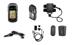
Garmin eTrex 32X GPS
Brand: Garmin
Reference: 010-02257-01
€255.16
Product sold out, not available at this time.
Next stock entry on the way, expected
Description
The Garmin eTrex series is renewed with the new handheld devices in the eTrex X range. The Garmin eTrex 32X will allow you to record up to 2000 waypoints with a storage capacity of 8GB. This model incorporates a compass and altimeter.
Details
More information
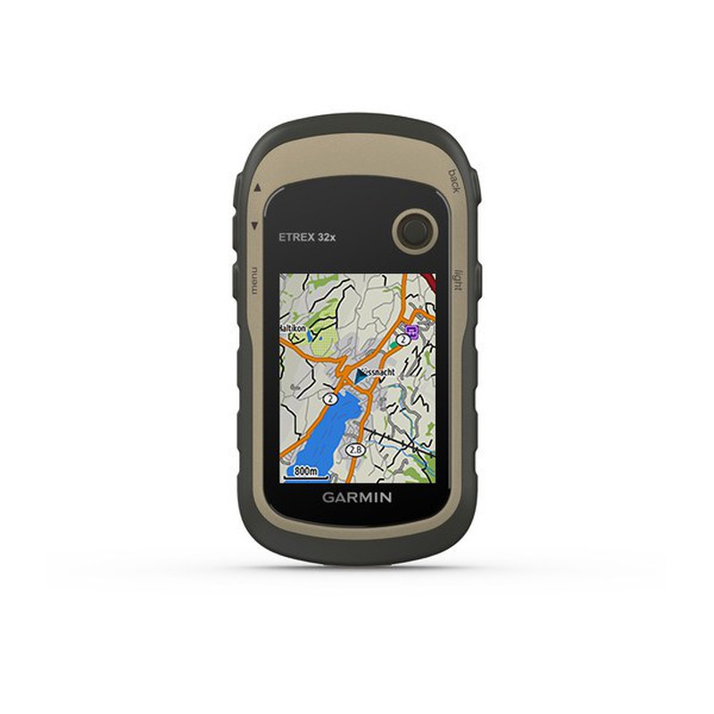
The Garmin Etrex 32X is an ideal handheld GPS device for any hiker. The evolution of the historic Etrex series incorporates features from its most advanced and innovative predecessors. Among all these, the 2.2 "color screen , the GPS and GLONASS connectivity and an internal memory of up to 8GB stand out .
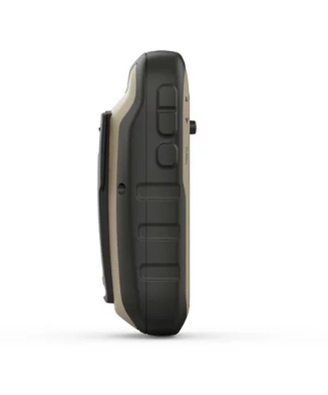
The 2.2 " full color (65,000 color) transflective display improves vision, even in bright light and reflections. Its dimensions are 3.5x4.4cm and 5.6cm diagonal (2.2"). Both the display and the equipment are resistant to water, dust and environmental conditions , making it a truly all-terrain model.
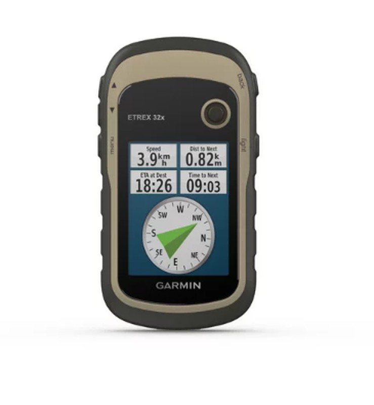
It includes a communication via GPS and GLONASS , these two systems give it much more accuracy when locating your location on the map. It will be able to track you even in the most remote places. It already includes the pre-installed TopoActive maps of Europe, with the ability to add much more cartography, both in internal memory and with an SD card .
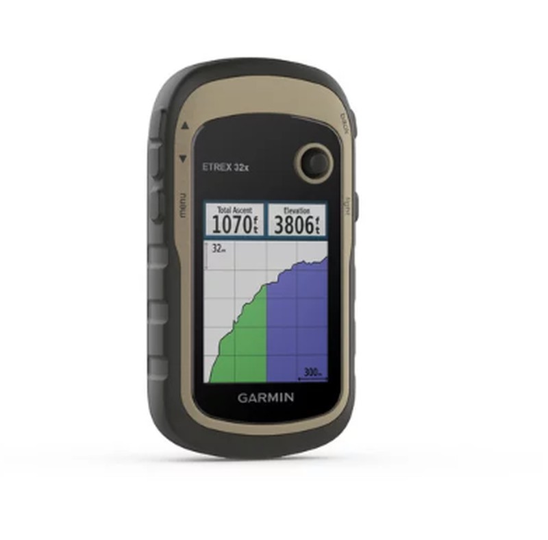
The eTrex 32X includes a barometric altimeter and compass . Two accessories of indispensable use in hiking, hiking and orientation.
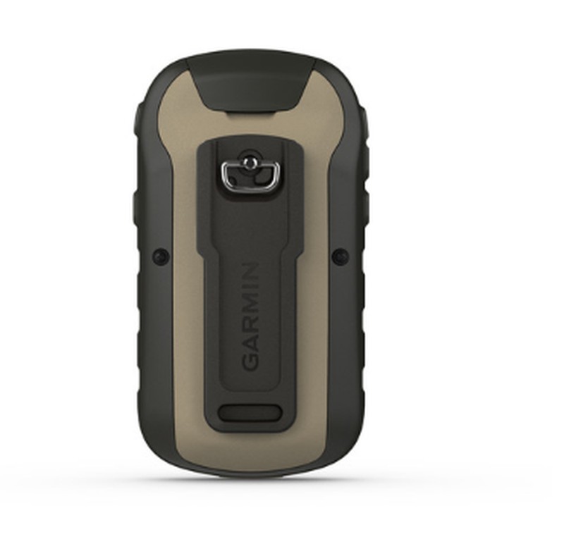
The internal memory is 8GB , this memory allows you to download maps completely and you can also add a MicroSD card to expand the memory, in the slot that you will find behind the battery. This GPS is capable of creating up to 2,000 waypoints and 200 routes.
It works with AA batteries , to be able to be NiMH or lithium and it has an autonomy of 25h. The total weight of the equipment is 142g, a very light device.
Characteristics:
The Garmin Etrex 32X is an ideal handheld GPS device for any hiker. The evolution of the historic Etrex series incorporates features from its most advanced and innovative predecessors. Among all these, the 2.2 "color screen , the GPS and GLONASS connectivity and an internal memory of up to 8GB stand out .
The 2.2 " full color (65,000 color) transflective display improves vision, even in bright light and reflections. Its dimensions are 3.5x4.4cm and 5.6cm diagonal (2.2"). Both the display and the equipment are resistant to water, dust and environmental conditions , making it a truly all-terrain model.
It includes a communication via GPS and GLONASS , these two systems give it much more accuracy when locating your location on the map. It will be able to track you even in the most remote places. It already includes the pre-installed TopoActive maps of Europe, with the ability to add much more cartography, both in internal memory and with an SD card .
The eTrex 32X includes a barometric altimeter and compass . Two accessories of indispensable use in hiking, hiking and orientation.
The internal memory is 8GB , this memory allows you to download maps completely and you can also add a MicroSD card to expand the memory, in the slot that you will find behind the battery. This GPS is capable of creating up to 2,000 waypoints and 200 routes.
It works with AA batteries , to be able to be NiMH or lithium and it has an autonomy of 25h. The total weight of the equipment is 142g, a very light device.
Characteristics:
- UNIT DIMENSIONS (WIDTH / HEIGHT / DEPTH): 5.4 x 10.3 x 3.3 cm
- SCREEN SIZE (WIDTH / HEIGHT): 3.5 x 4.4 cm; 5.6 cm diagonal (2.2 ")
- SCREEN RESOLUTION (WIDTH / HIGH): 240 x 320 pixels
- SCREEN TYPE: Transflective 2.2-inch TFT 65,000 colors
- WEIGHT: 141.7 g (with batteries)
- BATTERY 2 AA batteries (not included); NiMH or lithium recommended
- BATTERY / BATTERY AUTONOMY: 25 hours
- WATER RESISTANCE RATING: IPX7
- MEMORY / HISTORY: 8 GB
- HIGH SENSITIVITY RECEIVER: Yes
- EQUIPMENT INTERFACE: USB
- PRE-INSTALLED MAPS: Yes (TopoActive de Europa; with route setting function)
- POSSIBILITY TO ADD MAPS: Yes
- BASE MAP: Yes
- STORAGE AND CHARGE CAPACITY: microSD ™ card (not included)
- WAYPOINTS: 2000
- ROUTES: 200
- TRACKS: 10,000 points, 200 saved tracks
- BAROMETRIC ALTIMETER: Yes
- COMPASS: Yes
- AREA CALCULATION: Yes
- AUTOMATIC ROUTE CREATION (ROAD TURN TO ROAD) Yes (with optional maps with detailed road information)
- GEOCACHING MODE Yes (paperless)
- COMPATIBLE WITH CUSTOM MAPS: Yes
- HUNTING AND FISHING CALENDAR: Yes
- ASTRONOMIC INFORMATION: Yes
- IMAGE VIEWER: Yes
Comments
There are no opinions yet Be the first to review!
Questions
No questions yet Do you have any doubt?
Best price
Have you seen it cheaper?